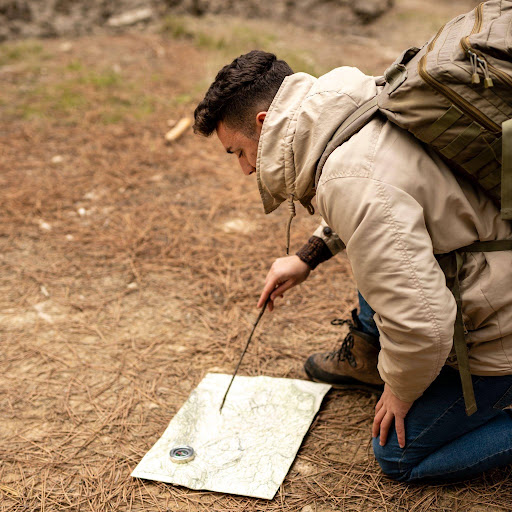
Every construction project begins with a need to understand the site. Before a building is designed, a road is aligned, or an infrastructure upgrade is planned, project teams need reliable information about the land, existing features, elevations, and site conditions. Without accurate measurements, even a well-prepared design can encounter unexpected challenges during construction.
Ground surveying provides the measurements and spatial information needed to support these decisions. It helps architects, engineers, contractors, developers, and property owners understand the physical characteristics of a location before committing to major work.
Whether the project involves a residential property, commercial development, road improvement, or utility installation, a carefully planned ground survey can help reduce uncertainty, improve coordination, and support more efficient use of resources.
What Is a Ground Survey?
A ground survey involves measuring and documenting selected features, positions, elevations, or boundaries on a site. The precise scope depends on the project’s purpose and the information required by the client.
Some surveys focus on topography, recording terrain, ground levels, visible structures, and other physical features. Others establish control points, determine positions for construction setting-out, or collect measurements needed to verify existing conditions.
A survey may also support boundary-related work, infrastructure planning, or the monitoring of structures. These activities can require different methods, equipment, professional qualifications, and deliverables.
The first step is therefore to establish what the survey needs to accomplish. A residential design may require a detailed site plan and elevation information, while a road project may need measurements along a long corridor. Industrial developments may require control networks and detailed mapping of existing facilities.
Defining the purpose helps ensure that the survey provides relevant information rather than unnecessary measurements.
Why Ground Surveys Matter Before Construction
Accurate site information provides a foundation for design decisions. When project teams understand existing ground levels, site dimensions, access points, and physical obstacles, they can develop plans that better reflect actual conditions.
For example, elevation information can help engineers plan grading, retaining structures, and surface drainage. Measurements of existing buildings and roads can assist with access planning and coordination with surrounding infrastructure.
Surveys can also help identify discrepancies between available drawings and current site conditions. A property may have changed since an earlier plan was prepared, or existing structures may not match the dimensions shown in older records.
Discovering these differences before construction begins can reduce redesign work and help prevent delays. However, a survey only establishes the information covered by its agreed scope; additional investigations may be necessary where hidden services, geotechnical conditions, or legal boundary questions are involved.
Common Types of Ground Surveying
Different projects require different surveying approaches. Understanding the distinctions helps clients select the appropriate service.
Topographic surveying
A topographic survey records natural and man-made features, often including elevations, contours, roads, walls, buildings, and drainage-related features.
Design professionals use this information to understand the site’s shape and prepare development plans. The required detail depends on the intended design, site complexity, and applicable project standards.
Boundary surveying
Boundary-related surveying concerns the location and measurement of property boundaries, subject to applicable legal and professional requirements. It may be needed when planning a development, resolving discrepancies in property information, or confirming the extent of a site.
A topographic plan should not automatically be treated as a legal boundary determination. Clients should confirm whether the project requires boundary verification and whether the provider is authorized to carry out that work.
Construction setting-out
Setting-out transfers positions and elevations from approved design information onto the physical site. Surveyors may mark building corners, grid lines, foundation positions, road alignments, or other design features so construction teams can work to the intended layout.
Accurate setting-out helps reduce positioning errors and supports coordination between design drawings and field operations.
As-built surveying
An as-built survey records the actual location or dimensions of constructed features. It can be used to compare completed work with design information, support project handover, and maintain accurate records for future maintenance or modifications.
The required detail depends on the contract, project specifications, and the intended use of the final documentation.
The Role of a Professional Surveyor in Dubai
Dubai’s built environment includes residential communities, commercial properties, industrial facilities, transport infrastructure, and major development projects. These environments often require coordinated measurements and clear technical documentation.
A professional surveyor in Dubai may support projects by collecting site measurements, establishing survey control, preparing drawings, setting out construction elements, or checking completed work, depending on their qualifications and authorized scope of practice.
Professional competence matters because survey data can influence important engineering and construction decisions. A surveyor needs to understand measurement methods, coordinate systems, equipment limitations, quality control, and the documentation required for the project.
Clients should verify relevant credentials, registrations, and approvals rather than relying on job titles or marketing claims alone. Requirements can vary according to the survey type, project location, and authority responsible for the work.
Clear communication is equally important. The surveyor should understand the design team’s objectives and explain what the collected data can—and cannot—establish.
Surveying Technology and Equipment
Modern surveying combines established measurement principles with digital tools that improve data collection and processing.
Total stations
Total stations measure angles and distances to determine the positions of points. They are widely used for detailed site surveys, construction setting-out, and establishing relationships between measured features.
Their performance depends on correct setup, suitable control, environmental conditions, and the quality of the measurement procedure.
GNSS equipment
Global Navigation Satellite System equipment uses satellite signals to determine positions. It can be useful for establishing control and collecting coordinates over larger areas where suitable satellite visibility and correction services are available.
Buildings, reflective surfaces, obstructions, and other conditions can affect measurement quality, so GNSS is not equally suitable for every location.
Digital levels
Digital levelling equipment can be used to determine differences in elevation with a high degree of precision when suitable procedures are followed. Elevation measurements may be essential for drainage, road construction, floor levels, and other applications where vertical accuracy matters.
Laser scanning and digital mapping
Laser scanning can collect large amounts of spatial information about buildings, structures, and surrounding environments. Depending on the equipment and processing workflow, the resulting data can support detailed three-dimensional models and measurements.
Technology should be selected according to the required accuracy, project size, site conditions, and final deliverables—not simply because a particular tool is available.
Understanding Coordinates, Levels, and Accuracy
Survey data must be referenced consistently to be useful. A coordinate reference system defines how positions are represented, while a vertical datum provides the reference used for elevation measurements.
If survey data is prepared using incompatible references, it may not align correctly with other drawings or existing infrastructure information. This can create confusion during design coordination or construction setting-out.
Before fieldwork begins, project teams should confirm the required coordinate system, elevation datum, units, and accuracy specifications. For projects in Dubai, these details should be checked against the relevant project documentation and authority requirements.
Accuracy should also be appropriate for the intended purpose. The needs of preliminary site planning may differ from those of detailed construction setting-out. A professional survey provider should explain how measurements will be controlled, checked, and documented.
Preparing for a Ground Survey
Preparation helps ensure that fieldwork is productive and the results match the client’s requirements.
Before the survey begins, provide the site location, intended survey limits, available drawings, and a description of the proposed work. If the project involves a new building, road, or utility connection, sharing preliminary design information can help the survey team identify the relevant features.
Site access should be arranged in advance, particularly where work takes place within occupied buildings, restricted facilities, or active construction areas. Safety requirements and coordination with site personnel should be agreed before measurements begin.
Clients should also confirm the required deliverables. These may include CAD drawings, coordinate lists, contour plans, digital terrain models, setting-out records, or as-built documentation, depending on the scope.
Clear instructions reduce the chance of receiving a survey that is technically sound but unsuitable for the intended design or approval process.
Common Problems That Surveying Can Help Prevent
Incomplete or outdated site information can create problems during construction. Designers may underestimate changes in ground level, overlook existing structures, or base plans on dimensions that no longer reflect actual conditions.
Inconsistent coordinate references can also complicate the integration of survey drawings with architectural and engineering models. Similarly, unclear setting-out instructions may lead to errors in the placement of foundations, walls, or infrastructure.
A properly scoped survey can help address these issues by providing current, measured information and documenting the reference systems used. It cannot replace other specialist investigations, however. Soil stability, underground utility locations, and structural integrity may require separate technical assessments.
The most effective approach is to identify the information required by each discipline and coordinate surveying with the wider project team.
Choosing a Surveying Provider
When selecting a survey provider, consider relevant experience, technical capabilities, quality-control procedures, and familiarity with local project requirements.
Ask about the proposed methods, the expected accuracy, the equipment to be used, and the format of the final deliverables. Confirm whether the provider can meet the project’s schedule and whether any additional permissions or specialist services are required.
It is also worth discussing how uncertainties or discrepancies will be reported. Reliable documentation should make it clear which features were measured, what assumptions were applied, and whether any areas could not be accessed or surveyed adequately.
A provider’s ability to explain these matters clearly is an important part of the working relationship.
Conclusion
Ground surveying supports informed planning by providing accurate measurements of land, elevations, structures, and other relevant site features. When the scope is defined carefully and the results are checked against project requirements, survey data can improve design coordination and help reduce avoidable construction problems.
Engaging a qualified professional surveyor in Dubai can help project teams obtain site information appropriate to their objectives and technical requirements. Lyca Survey provides surveying-related services for clients seeking dependable measurements and project support. Before commissioning a survey, clients should confirm the required scope, deliverables, professional credentials, and applicable approvals. A well-planned ground survey provides a valuable foundation for development decisions, but it should be coordinated with any additional engineering or specialist investigations the project requires.